Original: $17.28
-65%$17.28
$6.05The Story
🇨🇦 Canada’s Maritime Provinces ITMB Map
Nova Scotia, New Brunswick & Prince Edward Island
Double-Sided Travel Map – Folded or Laminated
Scale: 1:530,000 | Size: 690mm x 1000mm
🧭 Explore the East Coast of Canada in Detail
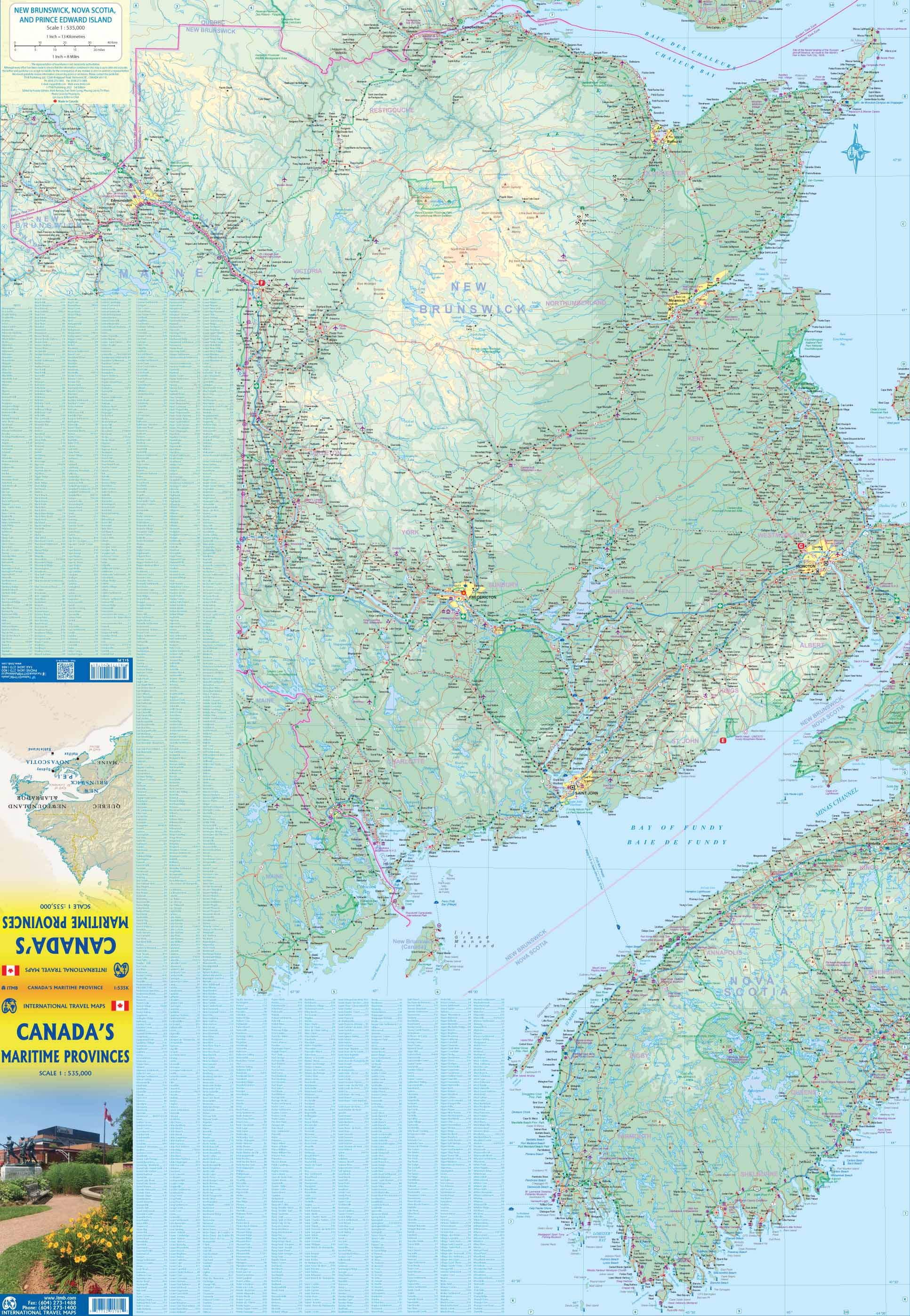
Dive into the rich history, natural beauty, and coastal charm of Eastern Canada with the Canada’s Maritime Provinces ITMB Map. This detailed double-sided travel map covers the iconic maritime provinces of Nova Scotia, New Brunswick, and Prince Edward Island, making it an indispensable tool for travellers, road-trippers, and map collectors alike.
Whether you're venturing along the legendary Cabot Trail, ferry-hopping to PEI, or discovering Acadian and Celtic culture in remote coastal villages, this map provides an essential planning companion with high cartographic clarity and easy usability.
🗺️ Map Coverage & Detail
Side 1:
-
Nova Scotia – including Cape Breton Island and the Annapolis Valley
-
CBD map of Halifax – with roads, landmarks, and tourist zones
-
Coastal roads, ferry lines, lighthouses, and beaches clearly marked
Side 2:
-
New Brunswick & Prince Edward Island
-
Includes major cities like Moncton, Saint John, Fredericton, and Charlottetown
-
CBD map of Sydney, Cape Breton’s largest town
-
Road classifications from major highways to back roads
-
National and provincial parks, scenic routes, cultural sites, and ferry connections
This map is perfect for navigating the scenic drives, winding coastal highways, and picturesque heritage towns of Canada’s eastern shores.
📐 Specifications
| Feature | Detail |
|---|---|
| Publisher | ITMB Publishing |
| Map Type | Folded (Laminated optional) |
| Scale | 1:530,000 |
| Coverage | Nova Scotia, New Brunswick, PEI |
| Inset Maps | Halifax, Sydney |
| Size (Flat) | 690 mm (w) × 1000 mm (h) |
| Size (Folded) | Approx. 243 mm × 110 mm |
| Print Format | Double-sided |
| Language | English |
🌟 Why Choose This Map?
| ✔ Feature | ✨ Benefit |
|---|---|
| 🗺️ Full coverage of 3 provinces | Plan with ease across NS, NB & PEI without flipping between maps |
| 🏞️ Top tourist destinations included | Highlights national parks, historic towns, and scenic drives |
| 🏙️ Inset city maps | Navigate Halifax and Sydney city centres with greater precision |
| 🚢 Ferry routes & bridges marked | Essential for planning multi-region maritime travel |
| 🧭 Clear topography and roads | Easily distinguish highways, routes, and natural features |
| 📏 Balanced scale | Detailed enough for local travel; broad enough for regional overview |
| 💧 Optional laminated finish | Waterproof, tear-resistant, write-on surface for rugged use |
| 🇨🇦 Perfect for Canadian travel | Designed by experienced Canadian cartographers at ITMB |
💼 Ideal Uses
-
🚗 Driving holidays through Nova Scotia, New Brunswick, and PEI
-
🚲 Cycle touring along scenic coastal roads and trails
-
🧳 Cruise stopovers and shore excursions
-
📚 Educational use or classroom displays
-
📌 Wall reference or travel planning at home or work
-
🗺️ Map collectors and fans of physical geography
🧱 Laminated Map Option
Want extra durability for outdoor or long-term use? Select the laminated version, ideal for plotting your routes or marking visited destinations:
-
🖊️ Use whiteboard markers without permanent marks
-
💧 Fully waterproof and tear-resistant
-
🔒 Encapsulated in 80-micron laminate for strength and clarity
-
✨ Note: light fold lines may still be visible beneath the laminate due to original folding
📦 Shipping & Availability
-
🏷️ Ships from Australia
-
🚚 In-stock folded edition ships next business day
-
🛠️ Laminated edition is made to order – please allow up to 10 business days for dispatch
🧭 Plan Your Atlantic Canada Adventure
From the red cliffs of PEI to the tidal wonders of the Bay of Fundy and the rugged beauty of Cape Breton Highlands, Canada’s Maritime Provinces are a feast for the senses—and this map is your perfect travel companion.
👉 Add it to your cart today and start planning your East Coast Canadian escape with confidence.
Details & Craftsmanship
Every detail has been carefully considered to bring you the perfect product.

Details & Craftsmanship
Every detail has been carefully considered to bring you the perfect product.

Details & Craftsmanship
Every detail has been carefully considered to bring you the perfect product.

Details & Craftsmanship
Every detail has been carefully considered to bring you the perfect product.
Description
🇨🇦 Canada’s Maritime Provinces ITMB Map
Nova Scotia, New Brunswick & Prince Edward Island
Double-Sided Travel Map – Folded or Laminated
Scale: 1:530,000 | Size: 690mm x 1000mm
🧭 Explore the East Coast of Canada in Detail
Dive into the rich history, natural beauty, and coastal charm of Eastern Canada with the Canada’s Maritime Provinces ITMB Map. This detailed double-sided travel map covers the iconic maritime provinces of Nova Scotia, New Brunswick, and Prince Edward Island, making it an indispensable tool for travellers, road-trippers, and map collectors alike.
Whether you're venturing along the legendary Cabot Trail, ferry-hopping to PEI, or discovering Acadian and Celtic culture in remote coastal villages, this map provides an essential planning companion with high cartographic clarity and easy usability.
🗺️ Map Coverage & Detail
Side 1:
-
Nova Scotia – including Cape Breton Island and the Annapolis Valley
-
CBD map of Halifax – with roads, landmarks, and tourist zones
-
Coastal roads, ferry lines, lighthouses, and beaches clearly marked
Side 2:
-
New Brunswick & Prince Edward Island
-
Includes major cities like Moncton, Saint John, Fredericton, and Charlottetown
-
CBD map of Sydney, Cape Breton’s largest town
-
Road classifications from major highways to back roads
-
National and provincial parks, scenic routes, cultural sites, and ferry connections
This map is perfect for navigating the scenic drives, winding coastal highways, and picturesque heritage towns of Canada’s eastern shores.
📐 Specifications
| Feature | Detail |
|---|---|
| Publisher | ITMB Publishing |
| Map Type | Folded (Laminated optional) |
| Scale | 1:530,000 |
| Coverage | Nova Scotia, New Brunswick, PEI |
| Inset Maps | Halifax, Sydney |
| Size (Flat) | 690 mm (w) × 1000 mm (h) |
| Size (Folded) | Approx. 243 mm × 110 mm |
| Print Format | Double-sided |
| Language | English |
🌟 Why Choose This Map?
| ✔ Feature | ✨ Benefit |
|---|---|
| 🗺️ Full coverage of 3 provinces | Plan with ease across NS, NB & PEI without flipping between maps |
| 🏞️ Top tourist destinations included | Highlights national parks, historic towns, and scenic drives |
| 🏙️ Inset city maps | Navigate Halifax and Sydney city centres with greater precision |
| 🚢 Ferry routes & bridges marked | Essential for planning multi-region maritime travel |
| 🧭 Clear topography and roads | Easily distinguish highways, routes, and natural features |
| 📏 Balanced scale | Detailed enough for local travel; broad enough for regional overview |
| 💧 Optional laminated finish | Waterproof, tear-resistant, write-on surface for rugged use |
| 🇨🇦 Perfect for Canadian travel | Designed by experienced Canadian cartographers at ITMB |
💼 Ideal Uses
-
🚗 Driving holidays through Nova Scotia, New Brunswick, and PEI
-
🚲 Cycle touring along scenic coastal roads and trails
-
🧳 Cruise stopovers and shore excursions
-
📚 Educational use or classroom displays
-
📌 Wall reference or travel planning at home or work
-
🗺️ Map collectors and fans of physical geography
🧱 Laminated Map Option
Want extra durability for outdoor or long-term use? Select the laminated version, ideal for plotting your routes or marking visited destinations:
-
🖊️ Use whiteboard markers without permanent marks
-
💧 Fully waterproof and tear-resistant
-
🔒 Encapsulated in 80-micron laminate for strength and clarity
-
✨ Note: light fold lines may still be visible beneath the laminate due to original folding
📦 Shipping & Availability
-
🏷️ Ships from Australia
-
🚚 In-stock folded edition ships next business day
-
🛠️ Laminated edition is made to order – please allow up to 10 business days for dispatch
🧭 Plan Your Atlantic Canada Adventure
From the red cliffs of PEI to the tidal wonders of the Bay of Fundy and the rugged beauty of Cape Breton Highlands, Canada’s Maritime Provinces are a feast for the senses—and this map is your perfect travel companion.
👉 Add it to your cart today and start planning your East Coast Canadian escape with confidence.