Original: $34.60
-65%$34.60
$12.11The Story
Trusted by Instructors. Designed for Precision. Built for the Sea.
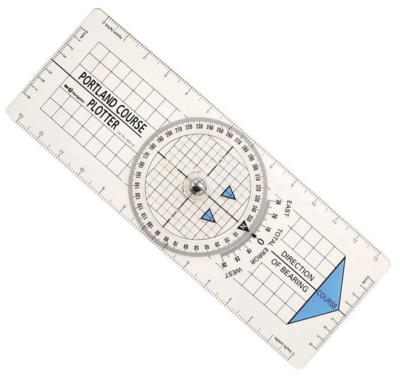
The Portland Course Plotter is a globally respected navigation aid used by professional mariners, sailing schools, and RYA instructors alike. Whether you're charting a coastal passage or teaching seamanship, this essential plotting tool ensures accurate, efficient course setting every time.
✅ Key Features
🔵 Bold Directional Arrow
A bright blue directional arrow clearly indicates course bearing—preventing accidental reciprocal plotting errors, even under pressure or low light.
📏 Graduated Edges for Speed & Tides
Both edges of the plotter are precisely graduated, allowing you to calculate tidal set, drift, and boat speed with ease.
🗺️ Fixed Grid for GPS Latitude Plotting
The transparent base features an integrated grid system, making it easy to plot latitude directly from your GPS or chart coordinates with confidence.
📘 Easy-to-Follow Instructions Included
Comes with a comprehensive instruction guide—ideal for beginners and a quick refresher for seasoned navigators.
🌍 Globally Trusted by RYA & Shore-Based Instructors
Used worldwide in both practical and classroom-based training, the Portland Plotter is a staple of maritime education and recreational sailing alike.
🧩 Perfect For:
✔️ Sailing students & RYA course participants
✔️ Cruising yacht skippers & recreational mariners
✔️ Naval cadets & instructors
✔️ Anyone learning or teaching traditional navigation
🛒 Add to Cart Now – Navigate with precision using the plotter trusted by professionals across the globe.
Description
Trusted by Instructors. Designed for Precision. Built for the Sea.
The Portland Course Plotter is a globally respected navigation aid used by professional mariners, sailing schools, and RYA instructors alike. Whether you're charting a coastal passage or teaching seamanship, this essential plotting tool ensures accurate, efficient course setting every time.
✅ Key Features
🔵 Bold Directional Arrow
A bright blue directional arrow clearly indicates course bearing—preventing accidental reciprocal plotting errors, even under pressure or low light.
📏 Graduated Edges for Speed & Tides
Both edges of the plotter are precisely graduated, allowing you to calculate tidal set, drift, and boat speed with ease.
🗺️ Fixed Grid for GPS Latitude Plotting
The transparent base features an integrated grid system, making it easy to plot latitude directly from your GPS or chart coordinates with confidence.
📘 Easy-to-Follow Instructions Included
Comes with a comprehensive instruction guide—ideal for beginners and a quick refresher for seasoned navigators.
🌍 Globally Trusted by RYA & Shore-Based Instructors
Used worldwide in both practical and classroom-based training, the Portland Plotter is a staple of maritime education and recreational sailing alike.
🧩 Perfect For:
✔️ Sailing students & RYA course participants
✔️ Cruising yacht skippers & recreational mariners
✔️ Naval cadets & instructors
✔️ Anyone learning or teaching traditional navigation
🛒 Add to Cart Now – Navigate with precision using the plotter trusted by professionals across the globe.